Top Land Surveyors in Kolhapur

Ground Water Survey: Groundwater surveys are an important tool for managing groundwater resources. They provide information about the quantity and quality of groundwater, as well as the factors that affect its availability. This information can be used to make decisions about where to drill wells, how to manage groundwater resources, and how to protect groundwater quality.

GPS Survey: GPS receivers are used to collect data from GPS satellites, which are then used to calculate the position of the receiver. GPS surveys can be used to measure distances, areas, and volumes, and to create maps and models of the Earth’s surface.
Hydrography Survey: Hydrography is the science of measuring and describing physical features of the navigable portion of the Earth’s surface and adjoining coastal areas. This includes the measurement of water depth, bottom configuration, tides, currents, and other physical characteristics.

Drone Survey: Drone surveying is an aerial survey conducted using drones to capture aerial data with downward-facing sensors. It is frequently used by surveyors and engineers in construction for terrain assessments and mapping. In addition to surveying, firms also use drone mapping to identify job-site errors, track work progress, predict schedule delays, etc.

Forest Survey : Forest survey is a systematic assessment of the forest resources in a particular area. It can be used to collect information on the type, size, and condition of the trees, as well as the presence of other vegetation, wildlife, and water resources.
Transmission Survey : Transmission survey is a process of collecting data about the location, condition, and ownership of transmission lines. This data is used to plan, design, and construct new transmission lines, as well as to maintain existing lines.

Marine Survey : Marine survey is an inspection of a marine vessel, such as a ship, boat, or yacht. The purpose of a marine survey is to assess the condition of the vessel and its systems, and to provide an opinion on its value. Marine surveys are typically conducted by a marine surveyor, who is a qualified professional with experience in inspecting and assessing marine vessels.

Road Survey :A road survey is a process of collecting data about a road, such as its location, width, and condition. This data is used to plan and design road improvements, such as widening or resurfacing.

Mining Survey : Mining survey is a critical part of the mining industry. It helps to ensure the safety of miners and the efficiency of mining operations.
.
DGPS Survey : DGPS is a valuable tool for improving the accuracy of GPS measurements. It is relatively easy to use and can be deployed quickly and easily. DGPS is also relatively affordable, making it a cost-effective solution for many applications.

Contour Survey : A contour survey is a process used to map the elevation of the Earth’s surface. It is done by measuring the elevation of points on the ground and then connecting those points with lines. The lines are called contour lines, and they represent points of equal elevation.

Building Survey : A building survey is an inspection of a property’s condition, carried out by a qualified surveyor. The survey will identify any potential problems with the property, such as structural damage, damp, or subsidence. This information can be used by the buyer to negotiate a lower price for the property, or to decide whether to buy it at all.
✅ Land Surveyors in Kolhapur & Nearby
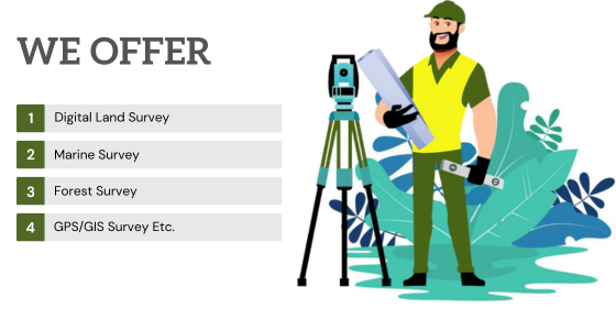
Are you searching land surveyors near me? Get land surveyors near you in 45 minutes for all over Kolhapur. Kaam Ke Bande will help you in taking away the pain of finding the trusted land surveyors to cater to your needs at affordable rates. Our professionals are highly skilled and prompt with undertaking their projects.
There are no reviews yet. Be the first one to write one.
Top Land Surveyors in Mussoorie
Land surveyor is a professional who measures and maps land. They use a variety of tools and techniques to determine the boundaries of property, locate features on the land, and create accurate maps. Land surveyors are licensed by the state in which they practice, and they must meet certain education and experience requirements.
Why Do You Need a Land Survey?
There are many reasons why you might need a land survey. Some of the most common reasons include:
- To determine the exact boundaries of your property
- To obtain a building permit
- To subdivide your property
- To settle a boundary dispute
- To prepare for a sale or purchase of property
- To locate utilities and other underground features
- To assess the damage caused by a natural disaster
- To purchase or sell property: A land survey can help you to ensure that you are buying or selling the property that you think you are.
- To obtain a building permit: Many building permits require a land survey to be completed.
- To resolve boundary disputes: If you have a dispute with a neighbor about the boundary of your property, a land survey can help to resolve the dispute.
- To plan a construction project: A land survey can help you to plan the layout of a construction project and to ensure that it complies with all applicable laws and regulations.
What Does a Land Surveyor Do?
Land surveyors perform a variety of services, including:
- Boundary surveys: A boundary survey is used to determine the legal boundaries of a property. This type of survey is often used to resolve boundary disputes, obtain building permits, or create a record of a property’s boundaries.
- Topographic surveys: These surveys create a detailed map of the land, including its elevation, features, and vegetation. They are often used for planning construction projects, such as roads, buildings, or pipelines.
- As-built surveys: These surveys create a map of a completed construction project. An as-built survey creates a record of the physical condition of a property after it has been built. This type of survey is often used to document changes to a property, such as the addition of new buildings or structures, or the removal of existing features.
- ALTA/ACSM surveys: These surveys are used to provide title insurance companies with information about the boundaries of a property. They are required for most commercial real estate transactions.
- Subdivision surveys: These surveys are used to divide a large piece of land into smaller parcels. They are required by the government before a subdivision can be developed.
- Utility surveys: These surveys locate underground utilities, such as pipes, wires, and cables. They are required before construction can begin in an area where utilities are present.
Types of surveyors Service we provide?
There are many different types of surveyors, each with their own specialized skills and knowledge. Some of the most common types of surveyors include:
- Land surveyors are responsible for measuring and mapping land boundaries. We use a variety of tools and techniques to determine the location of property lines, including GPS, lasers, and surveying instruments. We are work with real estate transactions, construction projects, and legal disputes.
- Engineering surveyors use their skills to plan and design construction projects. We measure and map the land, and then use this information to create plans for roads, bridges, buildings, and other structures. We also work on environmental projects, such as the construction of dams and pipelines.
- Mining surveyors use their skills to locate and map mineral deposits. We use a variety of tools and techniques to measure the depth and extent of mineral deposits, and then use this information to plan and develop mining operations.
- Hydrographic surveyors use their skills to map bodies of water, such as lakes, rivers, and oceans. We measure the depth and width of water bodies, and then use this information to create nautical charts and other navigational aids.
- Geodetic surveyors use their skills to measure the size and shape of the Earth. We use a variety of tools and techniques to measure the Earth’s gravity field, and then use this information to create accurate maps and globes.
- Aerial surveying uses airplanes, helicopters, or drones to collect data about the Earth’s surface.
- Cadastral surveying is the process of creating and maintaining maps of land ownership.
- Environmental surveying is the process of collecting data about the environment, such as air quality, water quality, and soil quality.
- Photogrammetry is the process of creating maps and models from photographs.
- Remote sensing is the process of collecting data about the Earth’s surface from a distance, such as using satellites or radar.
- Marine surveyors inspect and assess the condition of boats and ships. They can provide information about a vessel’s value, seaworthiness, and any potential problems.
- Aviation surveyors map and measure land and structures for use in aviation. They can be used to create airport layouts, plan flight paths, and identify potential hazards.
